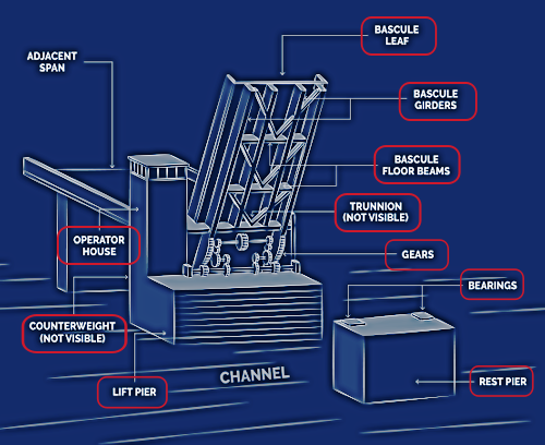
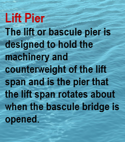
|
This webpage and its content were developed in cooperation with the New Hampshire Department of Transportation (NHDOT) as mitigation for the loss of the 1949 Neil R. Underwood Bridge.
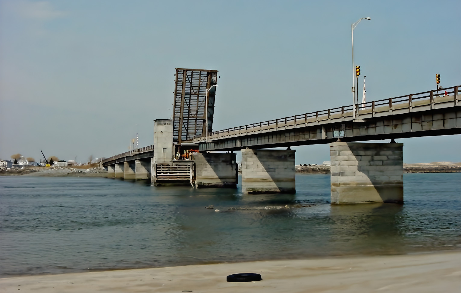
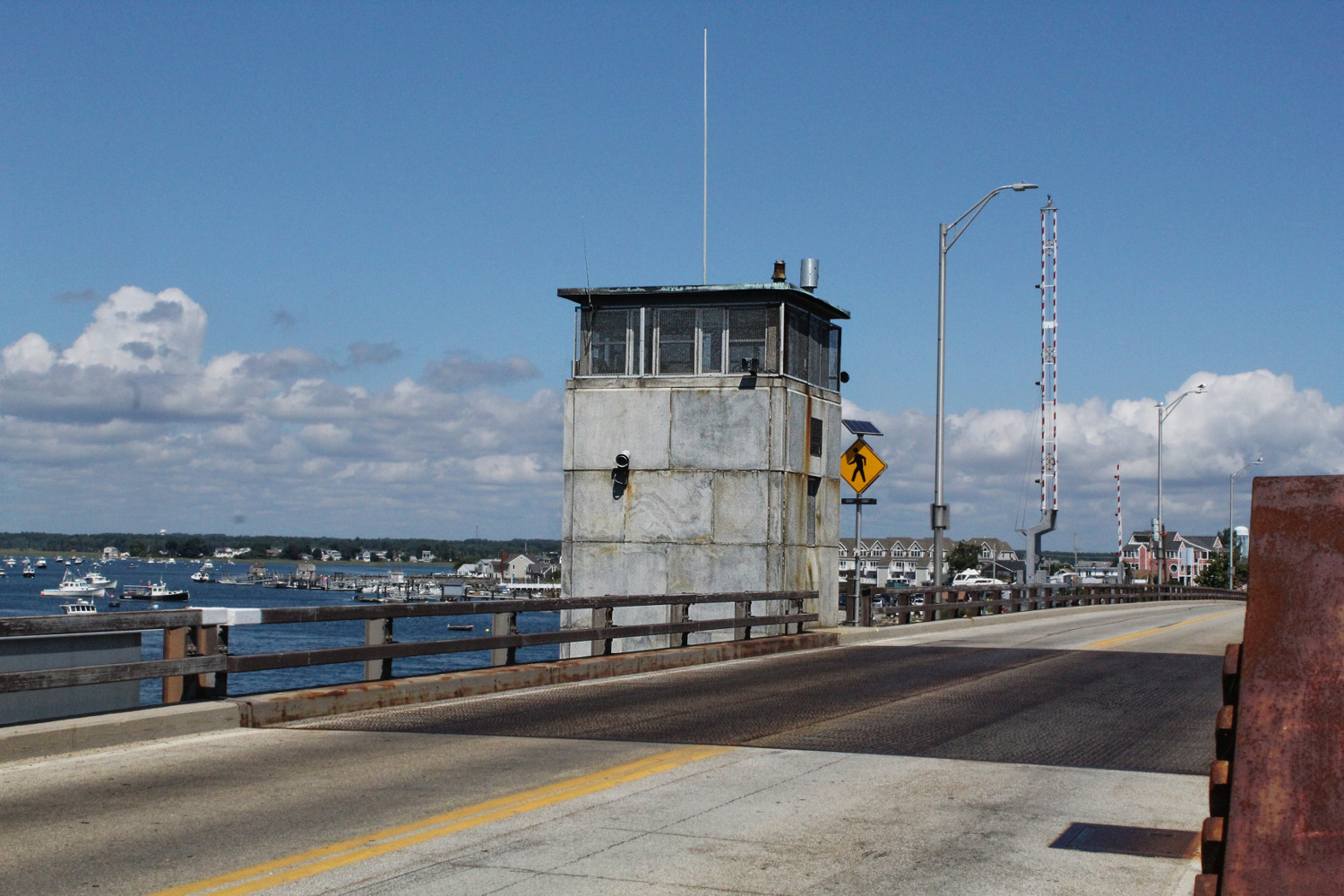
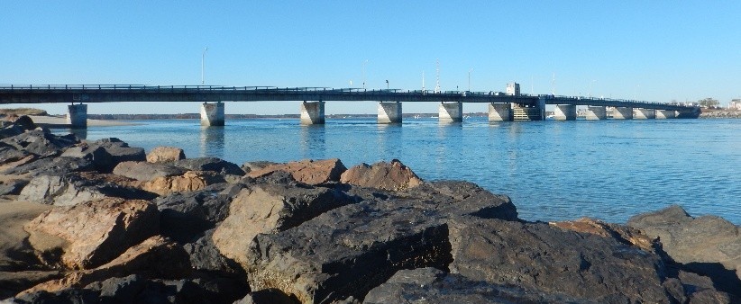
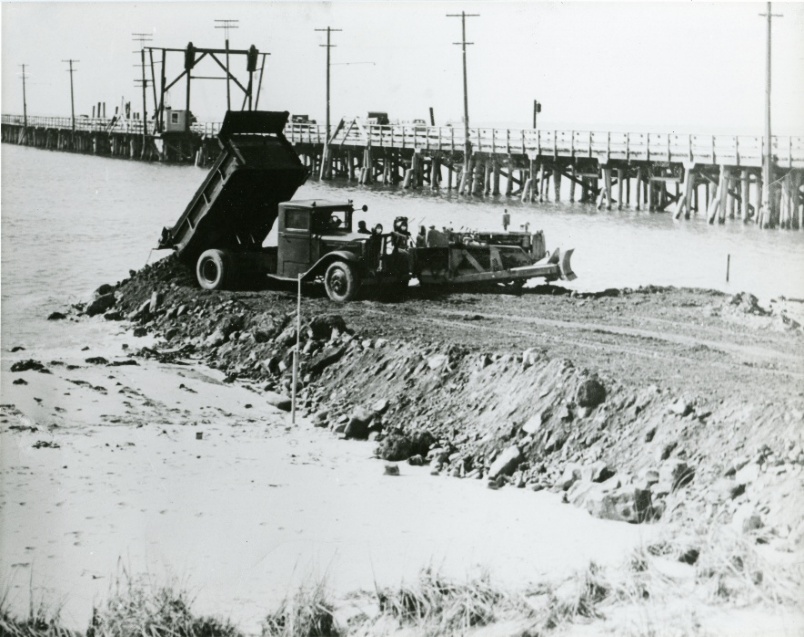
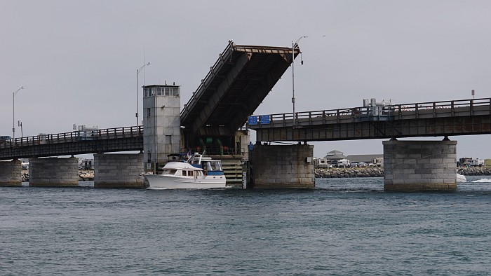
The Hampton River Toll Bridge, later renamed the Neil R. Underwood Memorial Bridge to recognize a World War II Army Lieutenant from Hampton, carried NH Route 1A over the Hampton River at the inlet to Hampton Harbor. The bridge was opened in 1949 and served as a vital transportation link between Hampton Beach in the north and Seabrook in the south, accommodating up to 18,000 vehicles per day during summer peak times. It replaced an earlier bridge at the crossing, the "Mile-Long Bridge," thought at the time to be the longest wooden bridge in the world.
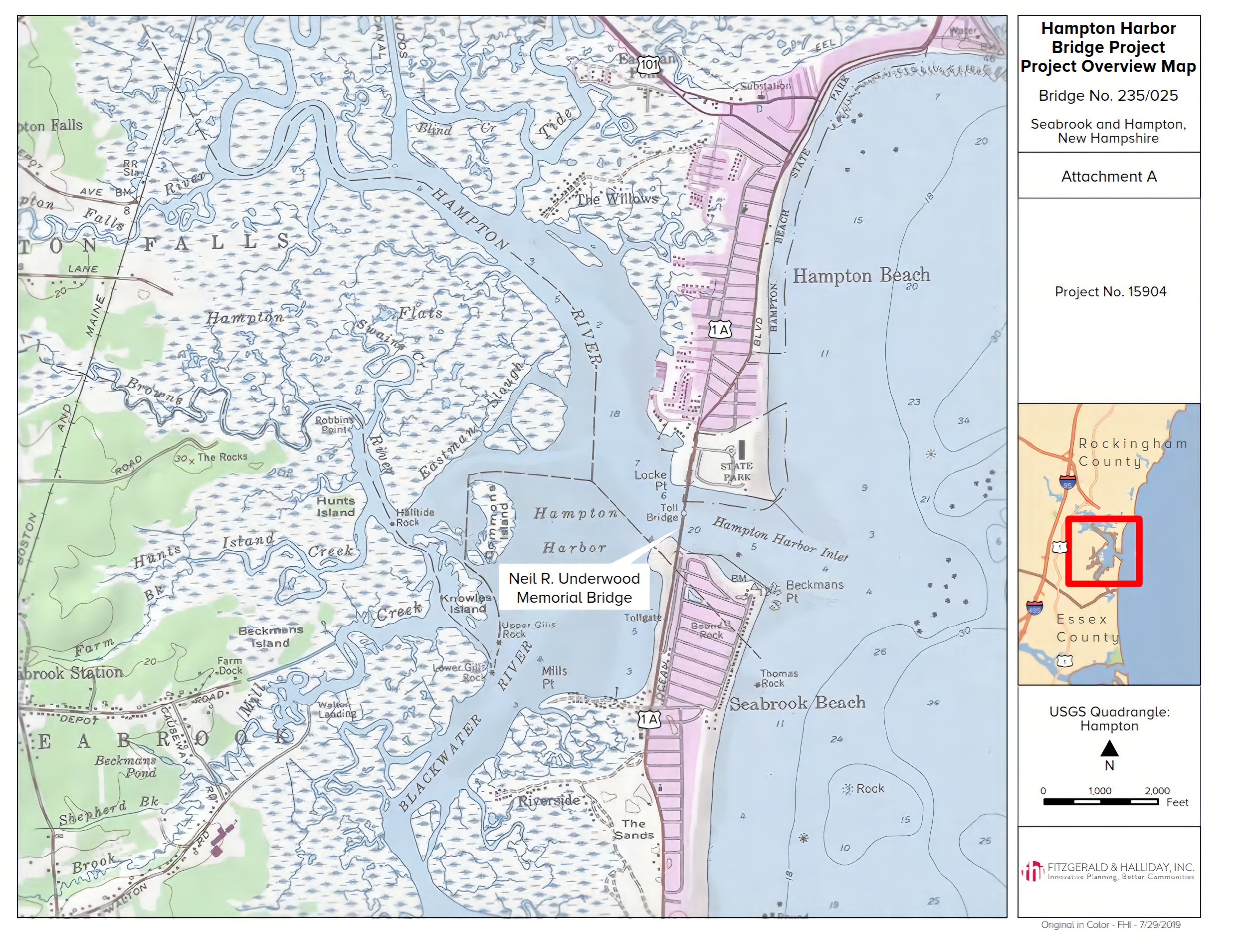
The Neil R. Underwood Bridge is located at the confluence of the Blackwater River and the Hampton River, where they form Hampton Harbor and outlet to the Atlantic Ocean. The bridge crosses a wide inlet that experiences powerful currents, tides, ice floes, wind, and storms. The natural forces of the ocean have created a changing landscape, with the build up of sand and sediment around rocky outcroppings.
Over time, harsh weather contributed to the deterioration of the Neil R. Underwood Bridge, and in 2018 planning began for its replacement. The new fixed bridge maintains the critical physical connection between Seabrook and Hampton and meets the maritime, recreational and commercial needs of the communities.
|
|
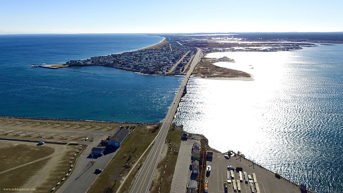
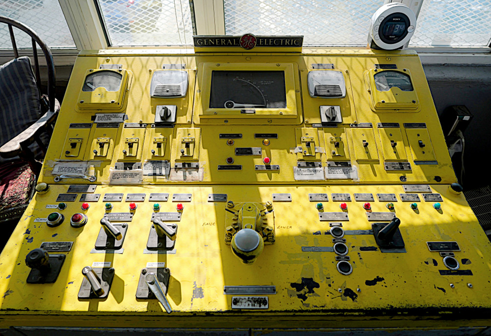
 This is a medium-res image (larger than it appears on the screen). To enlarge it on-screen, use pinch-zoom on a tablet or smartphone; on a desktop system, click the image to see a full view (use your browser's Back to come back here).
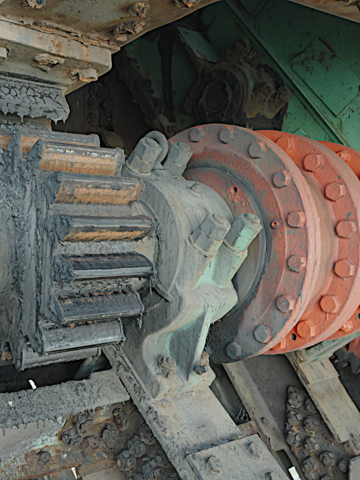