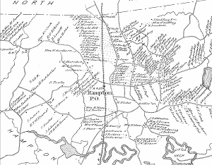
The map, printed on one large sheet, is really divided into 2 sections, one showing all of Hampton, and the other showing a more detailed view of Hampton Beach. We have made separate image files from each section, plus a third, a blowup of the center of town.
The 3 versions are available for view/download, via links below. Clicking any of these links will display the large image on your screen (although some browsers might be set to automatically downscale pictures to fit the screen). Each will take a long time to finish displaying - as long as 3 minutes with a 56K dial-up connection. Wait until it is fully displayed (your browser's activity indicator will stop).
For more information about saving images on this website to your harddrive and then printing them, click here. Do not use your browser to print these images.
After displaying an image and saving it, use the Back button on your browser to return to this page.
Click the small map below to display it in full-size.
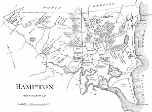
Click the small map below to display it in full-size.
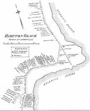
Click the small map below to display it in full-size.