|
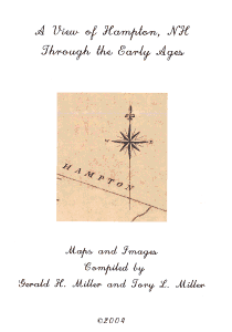
This booklet contains images of maps, lithographs that have been copied and reproduced by Gerald H. Miller and his son Tory Miller for the purpose of showing snapshots of the area as shown through the art of these early maps and lithographs. These images range in time from 1806 up to 1892.
The booklet is spiral-bound and beautifully printed on photo-quality 8.5x11 inch paper.
Contents:
- This booklet starts with an image of Great Boars Head and Hampton Beach in 2004.
- The next series of images comes from the 1806 Town of Hampton survey by Thomas Leavitt as required by the General Court in 1803.
- The next series of images comes from the 1806 Town of Hampton engraved by James Akin.
- The next series of images comes from the 1818 Carrigain Map of the State of New Hampshire.
- The next series of images comes from the 1854 Township and Rail Road Map of New Hampshire.
- The next series of images comes from the 1857 Map of Rockingham County, New Hampshire.
- The next series of images comes from the 1892 State Atlas.
|


